A model approximates the world. No matter how closely it tries to resemble it, a model always falls short of what it seeks to approximate. All models are created with a purpose and that intention shapes them intrinsically (their contents, their form, the relations between their components). Because they are built with an aim, models are extremely powerful. They help us grasp our surroundings, make decisions, allocate responsibility, create objects, and conceive of alternative worlds. Models have the power to create realities.
Because they have aims, all models carry technical and social perspectives from their origins. Model makers decide what to include and what to leave out, depending on existing data and the aim. *1 Models are not transparent reflections of the world; they are approximations oriented toward specific questions. This is essential to their nature, as models are historical and human-made objects. All models embody stances on the world; all models are assessed by their use.
Whenever you create a model, you make decisions about simplification. You seek to produce a model as simple as possible to yield the best possible.
Despite their commitment to simplicity, models that reveal worlds that are not accessible to the senses—such as outer space, the atmosphere, the economy, the deep ocean, or the underground—are especially enchanting. It is as if they brought those worlds into being, making what they restage knowable and potentially actionable, establishing senses of place, space, and time.
To make aquifers places rather than mere quantities of water, scientists and interested communities use a variety of models. Hydrogeologists, for instance, insist that the first thing you need to model an aquifer is to know the geological structure of the area. This is Rafa a hydrogeologist from the state subterranean water service in Costa Rica:
“Primero que todo, para yo conocer el modelo hidrogeológico, primero tengo que partir de lo que es la base, y la base siempre va a ser el modelo geológico.”
You must understand the geological structure through which water moves. Sometimes that is easy, but other times, as in Río Blanco, when things are a picadillo geológico (a geologic mash), it is much harder. But always your ultimate aim is to have different models for different objectives. Then you can move across them:
The question would basically be about the inputs required, right? Geological information, wells, soil data, hydrogeological elements such as, in addition to wells, springs, flow measurements, climate information—and then, once all those inputs are gathered, being able to begin analyzing and building models. Transitioning from the geological model to the hydrogeological model, and then from the hydrogeological model to the recharge model, the vulnerability model, and also, when there are public water supply sources like in Río Blanco, the protection zones model as well, to support proper management.
Rafa’s description divides models by themes or topics, that is, by the substantive matters they reveal: quantity of water infiltrating, rate of sustainable use, risk of pollution. Alternatively, we can think of models in terms of how they are created, what techniques they are made of.
In hydrogeology, there are three types of models: physical models (also known as scale models), conceptual models (which establish general relations among the main hydrogeological components), and numeric models (which rely on extensive numerical data to calculate specific features).
Physical/Scale Models
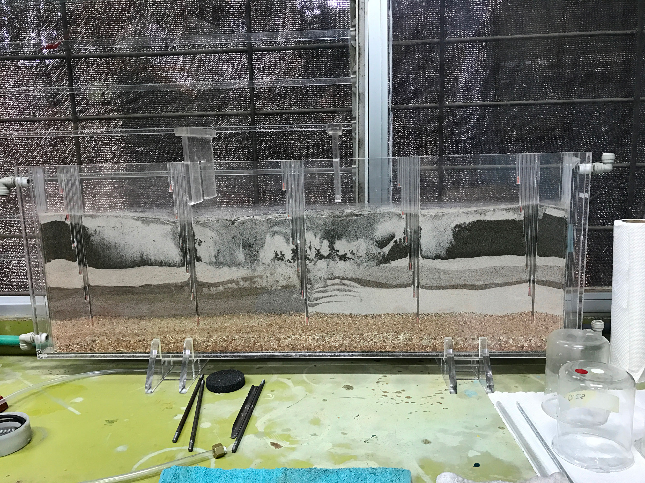
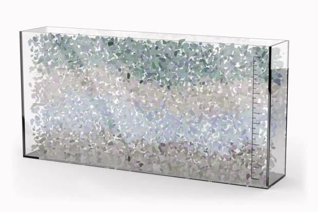
Physical/scale models replicate features of the world at a different scale. They mimic the form, materials, colors, appearance, sound, or smells of the world. In Río Blanco, the ASADA works with a variety of physical models of aquifers. Some are produced off-site in specialized factories (Figure 1) and are used to visualize geological layers and water dynamics below the surface.
The physical model in Figure 1 is sometimes called the “Sand Tank Model.” It is a thin plastic tank filled with layers of material of different textures and colors. Each layer consists of crushed rock or sand. Together, the layers convey a stratigraphic sense of the subsurface. If you look at the top of the model, you will see indentations and downward tubes representing water bodies (rivers, lakes) and wells.
The image in Figure 1 comes from a teaching lab in the Geology Department at the University of Costa Rica. The photograph was taken after a series of experiments to calculate Darcy’s Law had already run their course. As a result, we can see how the layers are mixed up, one bleeding into another. That condition represents weathering processes. Weathering transforms subsurface rock by dissolving and structurally altering layers through geochemical reactions as water, microorganisms, and other substances come into contact with rock.
People like Rafa activate this model by running simulation experiments. After set up, he pours water onto the top layer. Water then infiltrates and, depending on the objective, he could measure how long water takes to reach the bottom or using a syringe he draws water through the tubes to observe how wells can suck pollutants and contaminate water laterally.
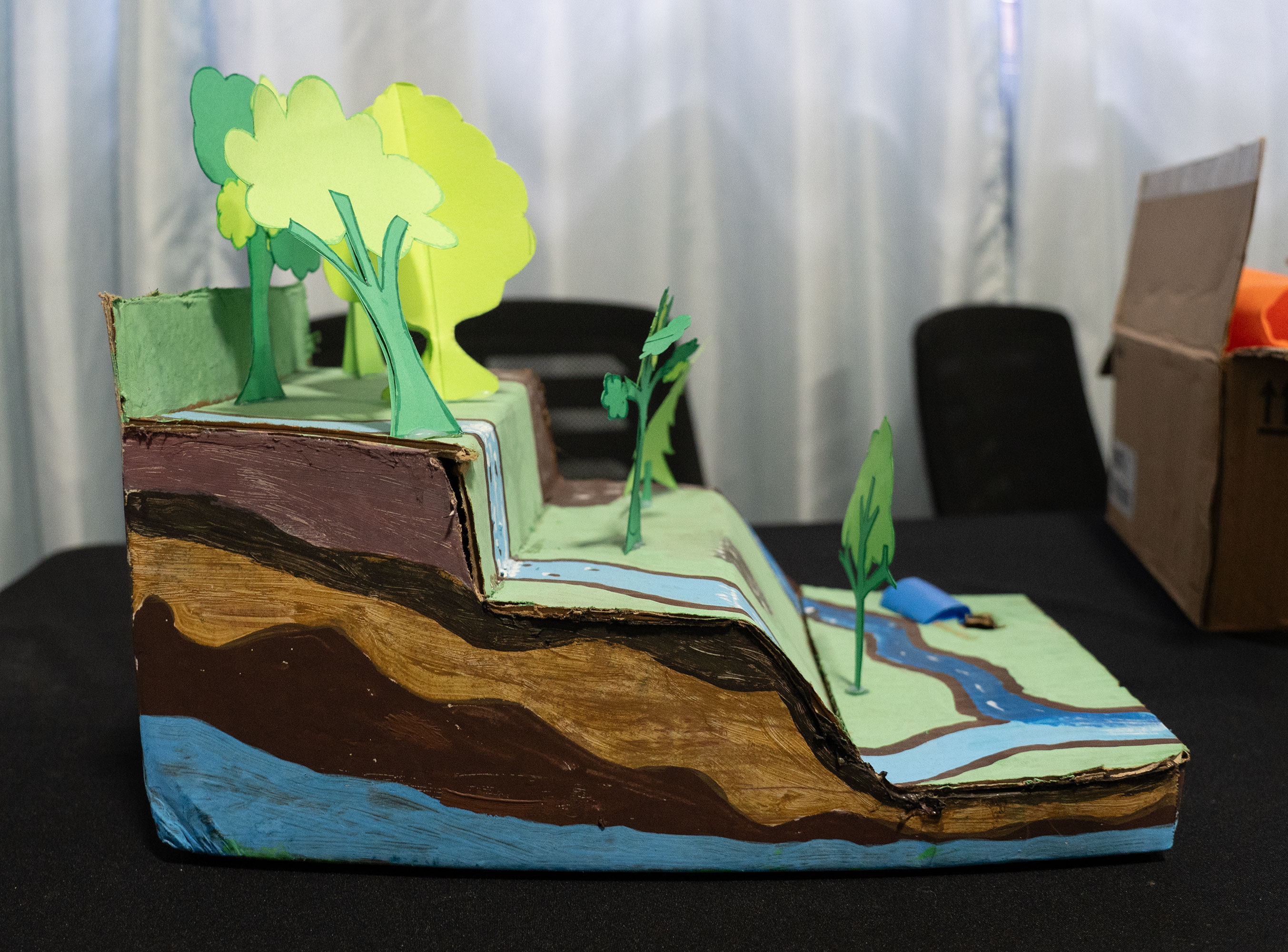
Other physical/scale models emerge from the ingenuity of community members. In Río Blanco, people draw on their extensive knowledge of infrastructure, rivers and aquifers to create scale models that convey the connection between surface and subsurface. This model (Figure 2) was created by Don Ronald, who works on infrastructure maintenance for the community water association. This model traveled to schools and fairs to communicate to the public the Association’s work.
Physical models are also called scale models because they shrink or enlarge what they represent, allowing for detailed inspection. Something too big for humans to sense (an aquifer or a planet) can be made small. Something too small (an atom or a rock pore) can be made big.
Scale models of aquifers really come to life through simulations such as the one we see on Figure 3. These kinds of simulations entwine the model’s materiality with stories and explanations of daily life. Water is injected from different points, we see it move in real time, pushing through the sand and gravel. Stories by the person working with the model emplace the movement of water
in climate change, rain, drought, pollution, water pumps turned on, flushing toilets, oil spills, broken pipes, and much more. The life force of water moves up and down; the subsurface becomes visible, we travel on the saddle of simulated accounts.
Conceptual Models
The second type of model prominent in the world of aquifers is the conceptual model. A conceptual model is scientifically produced to represent the general physical structure (geology, aquifer geometry) and process structure (recharge, discharge, flow, boundaries) of an aquifer or aquifer system. A conceptual model condenses the best existing knowledge but does not get to the detailed data that makes up numeric model.Enemark, Trine, Luk Peeters, Dirk Mallants, Brady Flinchum, and Okke Batelaan. “A Systematic Approach to Hydrogeological Conceptual Model Testing, Combining Remote Sensing and Geophysical Data.” Water Resources Research 56, no. 8 (2020): 1-19. https://doi.org/https://doi.org/10.1029/2020WR027578.; Wes Danskin, “Conceptual Model,” San Diego Hydrogeology, U.S. Geological Survey California Water Science Center, last modified July 2023, https://ca.water.usgs.gov/projects/sandiego/models/conceptual.html. Nevertheless, without a conceptual model there is no numeric model. It is often turned into a block diagram or cross-section.
Conceptual models of aquifers typically include nine data sources: geomorphology, geology, geophysics, climate, vegetation, soils, hydrology, hydrochemistry/geochemistry, and anthropogenic aspects.Anderson, Mary P., William W. Woessner, and Randall J. Hunt. Applied Groundwater Modeling: Simulation of Flow and Advective Transport. London, UK: Elsevier, 2015. (pg 30) https://agualabs.edublogs.org/files/2022/02/Applied-Groundwater-Modeling-Second-Edition-Simulation-of-Flow-and-Advective-Transport-by-Mary-P.-Anderson-William-W.-Woessner-Randall-J.-Hunt-z-lib.org_.pdf So, even if it is conceptual, this model can also incorporate quantitative data.
The level of detail of a model is captured by the term resolution. Determining the right resolution depends on the question the model aims to answer. Sometimes it is necessary to add dimensions and data to increase resolution, which creates tension with the commitment to simplicity that undergirds all modeling efforts. But conceptual models typically include limited dimensions due to data limitations. For that reason, conceptual models are also understood as a system of hypotheses.
Numeric Models
But the more data you add, the more you potentially shift from a conceptual to a numeric model. Rich Pauloo, a hydrogeologist, explains it this way:
If your question is how much water is there? I can almost figure that out just by measuring all the inputs and outputs. I can conceptualize the system as a box, and I can say how much evaporation is leaving, how much infiltration is coming in from streamflow, how much is coming in from irrigation in return flow. How much is leaving through interbasin flow? And then I could say the storage in the system is equal to the inputs minus the outputs. And I can calculate storage over time and show whether it is increasing or decreasing. It’s just like a bank account. That’s the most common metaphor I run into when people talk about water balances and water accounting.
Rich’s example is a numeric model that demonstrates the problem of data availability (quantity of data) accessible to increase resolution.
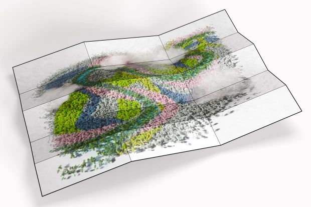
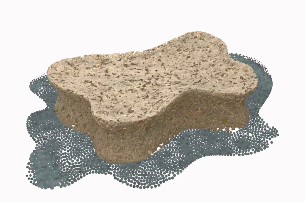
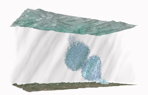
To address lack of data for numeric models, scientists create a cell or grid system that allows them to make assumptions in four dimensions (Figure 5). They project the data they have to other cells in the grid. This allows them to calculate inputs and outputs, even when they lack all the data they would ideally need. Figure 5 is a graphic representation of the grid system from Rich Pauloo’s work.
*12Numeric models of aquifers have become increasingly visible in social life, not least because of advances in digital computation. In the late 1960s and early 1970s, groundwater models were analog, large circuit boards that operated on electric charges to simulate groundwater movement.
As computing capacities increased, numeric models became fully digital and incorporated data at much higher resolutions. This has led to what is now called “hyper-resolution models,” computational frameworks that integrate machine learning (a type of artificial intelligence) and physics-based simulations. These models offer insights into groundwater systems at scales smaller than one km without requiring extensive observational data. However, these models are not widely used today and remain inaccessible to broader research communities without access to intense computing capacities, as well as to user communities, such as Río Blanco,
Physical-Conceptual-Numeric
Despite how we speak of different models, they are all intricately interconnected. Consider Rich Pauloo’s explanation:
*10 [If you want to find out where pollution is coming from] you need to understand something about the geology, because that contaminant moving through the system is proportional to the sedimentary conductivity. Imagine you have a jar full of marbles. You pour water through them all. Water moves fast through the cracks. If you have a jar full of clay, you pour water. It’s going to sit on top. So it’s going to take a long time to move through. So you need to know what’s called hydraulic conductivity.
His description of a numeric model includes a second model, a physical one. The second model is a jar: in one instance, full of marbles and in another, full of sand. Each jar has the enchanting capacity to replicate highly complex material processes that numeric models can obscure by reducing them to abstract values. The physical model enhances the numeric model, which is, in a way, also a conceptual model.
Physical models provide insights because they resonate materially with the worlds they replicate. They restage volumetric complexity, material qualities, and even changes over time. Conceptual models draw their power from the assumptions they entrench and solidify in the world, such as the structure and dynamics of an aquifer and how it contributes to a sense of shared purpose and solidarity. Numeric models yield detailed figures that shape life, determining things like how much water can be drawn from an aquifer before depletion.
All these models are interwoven. They shape what we understand as the purpose of collective life. All of them are stances on the world. They mold our relations to aquifers in ways that benefit some beings but not others. Models feed into both hope and despair, bringing us together or atomizing us into competing entities pulling in opposing directions.