Don Mario arrived in Río Blanco in the 1990s, coming from Turrialba, a town known as the door to the Caribbean for those who, during the 20th century, saw the world from Costa Rica’s Central Valley. He was seeking land where he could “echar unas vacas” (throw some cows) and set up a farm. His uncle had settled in Río Blanco years earlier. To throw cows, he first had to “open” the mountain, meaning create a clearing in the forest, a process that is hard work because it entails moving vast amounts of matter and organisms (trees and vegetation) and disrupting ecological relationships at both small and large scales, ultimately planting grasses to feed cows.
Today, Don Mario looks back on his actions with irony. “I understand,” he says, “one needs to make a living, but I would never do that again.” Since his arrival, Don Mario has held multiple occupations (farmer, tourism business owner, investor, environmental activist, and prominent participant in political organizations). Over time, he moved away from cattle ranching. The work he and his cows did transformed the landscape drastically and culminated in the sacrifice of most of the cows in mataderos. Those very cows allowed Don Mario to send his kids to college and make a decent living. The cows, his crops, and his ingenuity have brought him to the present, when he owns a small tourism business. He now welcomes cruise tourists to another piece of land he owns where he offers magnificent views, a canopy tour, and the experience of being inside the rainforest.
Recognizing how hard it is to start a farm and make a living, Don Mario comments on the people who are echando vacas y cortando palos (throwing cows and cutting trees) in the upper region of the aquifer today. He empathizes with them but is also worried about the aquifer’s future. Local organizations such as the ASADA have partnered with public agencies to hold workshops on sustainable cattle management to avoid the detrimental effects of cattle ranching on the environment: land compaction, pollution of surface and underground water sources, biodiversity loss due to forest clear-cutting, and greenhouse gas emissions. But issues remain.
Cows and their people have shaped Costa Rica’s landscape in deep and non-linear ways. Since their arrival on the continent in the 16th century with colonizers, cows have performed material labor that intensified the extraction and dispossession of indigenous peoples.Ficek, Rosa E. “Cattle, Capital, Colonization Tracking Creatures of the Anthropocene in and out of Human Projects.” Current Anthropology 60, no. S20 (2019): S260-S71. https://doi.org/doi:10.1086/702788. https://www.journals.uchicago.edu/doi/abs/10.1086/702788. Over centuries, cows have been active terraformers.
The physical changes brought about by cow-enabled extraction are most visible when we compare historical records. Figure 1 and Maps 1 and 2 offer just that. They show historical change in the landscape as seen from above, juxtaposing aerial photography and images produced with satellite data. These images not only document loss but cultivate a view at a distance and across time. This distinct position of observation tells its own story of Río Blanco (aquifer-river-town).
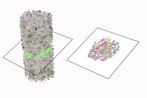
The earliest aerial photographs of Río Blanco date to the 1950s. The standard practice in aerial photography at the time was to shoot black-and-white photographs from airplanes flying at altitudes between 4500 and 6000 meters above sea level, with cameras mounted on the lower part of the aircraft. Each frame covered an area of 47-190 km2, depending on the altitude of the flight (Figure 1). Following a preplanned route, the airplane took a series of shots to produce a mosaic of images that was later assembled like a puzzle to provide full coverage of a region. Developed as a military technology, aerial photography furnished the Cold War with means for espionage and long-distance observation of the US and the USSR, as well as their spheres of influence.
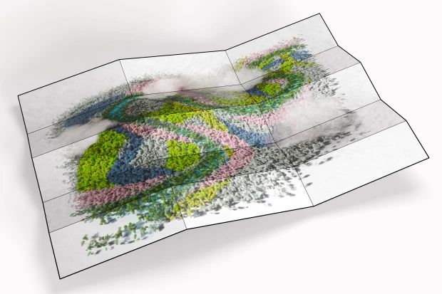
Maps 1 and 2 are based on 1952 aerial photographs that have been georeferenced and overlaid on a 2024 satellite-derived image, processed to mimic a color photograph. In the top-left corner of Figure 2, the satellite data underlayer appears in green. To notice the spectrum of land uses captured in the mosaic of 1952 photographs, one must adjust perception to become sensitive to a gradient of grays and blacks, along with a variety of textures.
In aerial photography and satellite imagery, texture creates the effect of touching with light. Texture renders plants, water, infrastructure, roofs, and everything else knowable from a distance. In black-and-white aerial photography, forests, for example, appear as dark, rippled gray patterns that, in 1952, occupy most of the photographic surface and allow us to see changes in elevation toward the lower-left corner of the image. As our eyes wander toward the coast on the right of the image, patches of land cleared of forest are lighter in tone.
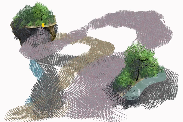
Studies produced by governmental agencies designed to see from above delineate the Río Blanco aquifer boundaries by tracing the limits of distinct geological formations. We have traced those boundaries with a red line in Maps 1 and 2. Within those boundaries, in the 1952 map, you can already see a large gap surrounded by dark-toned texture indicating forests. It is likely that this clearing was already used for cattle grazing. We have colored the gap a very light brown for easier observation.
The resolution of the photographic mosaic in Map 1 is not fine enough to see actual cows, but the straight lines within the clearing, consisting of trees planted in rows, indicate that some form of demarcation has occurred, most consistent with the division of pastureland for raising cattle. Other gaps in the forest within the higher part of the aquifer (down and to the left in the image) are less clear. They are smaller and perhaps signal small or early efforts to create pastureland.
The next image, Map 2, was composed from photographs taken in 1960. At that time, many of the clearings had grown larger, and we now see a clear linear demarcation of the borders of pastures with cercas vivas (live fences), boundaries that consist of live bushes and trees regularly trimmed and connected with barbed wire to keep animals within.
Between the 1950s and 1980s, two main activities led to the deforestation of most of Costa Rica’s territory: logging and cattle ranching. The intensification of cattle production, along with its rise and fall, deeply shaped the country’s future, influencing its relationship with forests, biodiversity, and the environment to the present day.
Over about 40 years, from the late 40s to the 80s, Costa Rica’s forested areas declined sharply from about 80% to between 20-30% of its territory. In 1977, Dr. Maria Eugenia Bozzoli predicted how Costa Rica would look in the year 2000 and diagnosed the total potrerización of forests (conversion of forests into grazing lands), a process that would eradicate ecosystems and intensify the concentration of land in the hands of rural elites, erasing opportunities for peasants beyond livestock expansion. At the time, those predictions were historical reflections. By then, small-scale farmers and landless campesinos had already been displaced, migrating to cities or occupying and using land without holding the property title—a practice labeled precarismo because of its legal implication of occupation in precarious legal conditions. Other rural residents moved to different parts of the country as “colonos,” securing land through government-led land reform programs. Many people in Río Blanco arrived that way.
In Latin America more broadly, campesinos have historically been scapegoated as drivers of deforestation, despite many scholarly works indicating that large landowners are responsible for forest loss on a larger scale.Anabelle Porras Zúñiga and Beatriz Vilarreal Montoya, Deforestación En Costa Rica (San José: Ed. Costa Rica, 1985). In Costa Rica, intense land-use change was facilitated by legal and policy incentives that primarily benefited the logging industry. This industry expanded the agricultural frontier and facilitated the entry of the cattle industry, capitalizing on the high demand for beef in the United States during the mid-to-late 20th century.Ibid., Porras Zúñiga and Vilarreal.
The province of Guanacaste, in the country’s Pacific northwest, was emblematic of this process.See Marc Edelman, La Lógica Del Latifundio: Las Grandes Propiedades Del Noroeste de Costa Rica Desde Fines Del Siglo XIX (San José, Costa Rica: Editorial UCR, 2019), It exemplifies a long history of land concentration dating back to colonial times, which peaked with export cattle ranching in the last quarter of the 20th century and has since spread to other areas along the Pacific coast. Ibid., Marc Edelman, 2019.Today, however, in Guanacaste, land concentration has given way to gentrification and the expansion of the transnational tourism industry, with its associated property-capture dynamics.
Cattle ranching expanded along the Caribbean coast, particularly in Limón, more gradually and largely driven by the need to find economic alternatives following the United Fruit Company’s withdrawal in the 1930s and the distinct process of colonization it brought about.Ronny Viales Hurtado, “La colonización agrícola de la región atlántica (Caribe) costarricense entre 1870 y 1930: El peso de la política agraria ambiental y de las diversas formas de apropiación territorial,” Anuario de Estudios Centroamericanos 27, no. 2 (2001): 57–100. As an alternative activity, cattle ranching took experimental forms. During the 1960s-70s, the government brought water buffaloes to the region to foster the consolidation of agribusinesses better “adapted” to local weather. Along with the water buffalo experiments, alternative crops included the reintroduction of cacao and banana plantations. Cattle ranching, however, remained key to the subsistence of campesino families and medium-scale landowners who had practiced these activities since the early days of Caribbean colonization.Ronny Viales Hurtado, “La colonización agrícola de la región atlántica (Caribe) costarricense entre 1870 y 1930: El peso de la política agraria ambiental y de las diversas formas de apropiación territorial,” Anuario de Estudios Centroamericanos 27, no. 2 (2001): 57–100.
In February 2025, we visited Don Jose’s finca (farm) above the Río Blanco aquifer. He told us he was preparing to sell his land. The cattle business was less profitable than he had expected. The air was filled with a light drizzle that soon turned into heavy rain. Before the downpour, we walked to the field where his cows were grazing. On the path, we slipped on mud, already beaten and repeatedly churned by the hooves of cows walking across the land. Figure X is a still image of the beginning of this process. Their weight pressed their hooves into the soil, first killing vegetation, then sinking deeper until, given the region’s abundant rain, it became a muddy conglomerate.
Mud results from the combination of abundant rainfall and the overuse of trails as cows move from one section of the potrero (grazing land) to another. In fincas, mud is really hard to avoid, though not impossible, don José explained. Cows continue to make it worse and worse as long as they are forced to follow the same routes. But cows themselves cannot do much about it. Mud is the outcome of cows’ inability to control their lives as domesticated animals, ultimately under human control, which restricts their movement to acceptable paths and pre-established times.
As a result of the rain, lack of vegetation, the weight of the cows, and their lack of freedom, small landslides dot small fincas in the hills of Río Blanco. This is a landscape that never stops changing, in both small and major ways. Decades ago, forests were cleared to make room for cows. Cows will now leave space for whatever comes next after Don José sells his land.
When cows roam in large numbers, they compact the soil, their manure contaminates aquifers and other water bodies, they contribute to greenhouse gas emissions, and, as we saw, they are involved in economic activities that drive deforestation (see also Tree). More recently, their relationship with aquifers has become clearer. Cows interact with the soil in contradictory ways, compacting and muddying it.
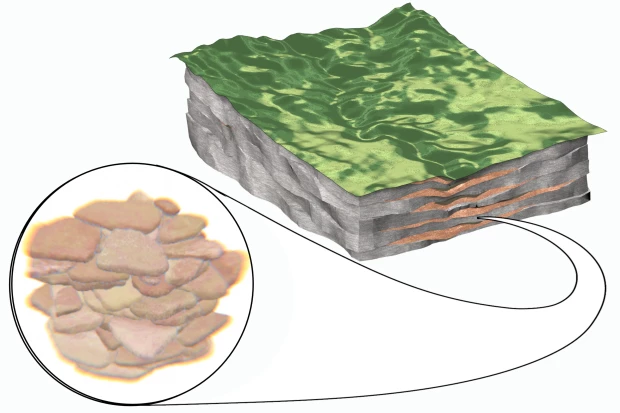
On the one hand, compaction interferes with infiltration, reducing the number of open granular pores through which rain can move inwards once it reaches the surface. This makes soil impermeable, creating puddles that accumulate water. On the other hand, nitrates and pathogens from manure and waste can seep into groundwater. In both volcanic and sandy coastal aquifers, the potential for this kind of infiltration is high. The water table is often shallow, the soil is highly porous, and waste moves easily, becoming a non-point source of pollution. Further down in the subsurface, waste moves through water in rock fractures or in the pores of sedimentary layers, quickly transporting pollutants downward and altering the quality of the water in the aquifer.
Don José has also had a change of heart. It seems to be a common trait among Río Blanco residents of a certain age. He explained that he is now more aware of the environmental impacts of cattle ranching than he was when he first set up his finca. His son is studying ecology at the university and has shared that knowledge with him. Don José told us he wished there were greater access to this information, education, and the dissemination of data on the environmental impact of cattle ranching. This is urgent given the major environmental changes he sees around him, particularly regarding water. He lives in a world and climate that have already changed:
Don José: But I will say one thing — something worries me. Until a few years ago, maybe two years, the land, the pastures, would retain the rain. The creeks always had water. Not anymore — now, when it rains, they fill up, and then after two days of sun, they dry out, the water gets absorbed. Even over there in Río Quito, in Río Victoria, there’s a part where the river disappears during long dry seasons. So that really concerns me because we’ve all started noticing it — all of us farmers talk about it. When it rains, the creek fills up, but just two sunny days and the water vanishes […] it wasn’t like that before. Water used to always be flowing — maybe just a little, but it would always stay on the surface. Now, no — two or three days of sun and the water is gone.
ED: So, why is that happening?
Don José: Good question. I wish — I wish someone would tell me scientifically what’s going on. I know it has to do with the same thing, with deforestation. But… I don’t know. I haven’t seen a documentary or anything that tells me: “Look, this is what’s happening. And if we don’t do something, the day will come when your cows will die of thirst because there will no longer be water in the creek.” Because that’s already happening. Not last year, but the year before — in 2023, there was a very harsh dry season here in Limón. Very harsh. It lasted about six months, and the concern was so great because the only river left was almost dry. So the cows had nothing. We even thought about bringing them water from the house. It’s a serious problem. It’s a problem that is already affecting everyone because it affects the animals, it affects us, and at some point, we’ll likely be left without water too.
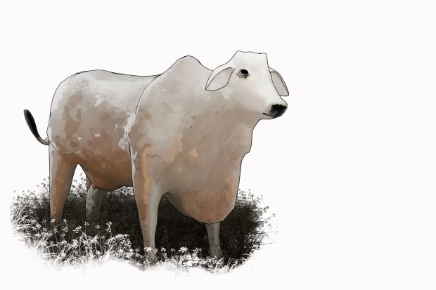
So far, we have moved between two categories with ease: cows (vacas) and cattle (ganado). Is there a difference between the two? For Marisol de la Cadena and Santiago Martínez, there is. Cow and cattle are not the same thing. Cattle are subject to the extraction of value deemed possible through assisted reproduction and to the management of life following Taylorism; they are not cows. Cows are inscribed in regimes of labor and work, but they are not industrially reproduced or lost in large numbers. Issues of scale matter here.
And yet, some cattle can also be cows, particularly in small operations. Perhaps cattle entail both a kind of operation and a form of ranching that has become a type of land use focused on managing bodies and life for maximum economic gain, following agribusiness models and intended to adapt to changing landscapes. To that extent, cattle ranching is also a transitional phase in a continuum of land transformations—more often than not, leading to the degradation of ecosystems and the potrerización of land at large scale. And yet, in Río Blanco, rather than alternatives, cattle and cows can flicker, taking each other’s place at different moments in people’s lives with their animals.
Most recently, cow turned cattle has become a stand-in for illicit economies, giving rise to the emergence of ‘narco-cattle.’ In Honduras, Guatemala, Costa Rica, Colombia, and Panamá, the connection between narco-trafficking and cattle expansion has revealed extensive money-laundering networks that are transforming the meaning and affordances of cows, as well as the everyday life of residents in areas such as Río Blanco. The ties between environmental degradation and narcotrafficking are all too present in Río Blanco, where proximity to the Moín port has resulted in the establishment of a key corridor for drug exports and imports. Casting cows in this light, as “narco-cattle,” does two things. First, it differentiates between cow and cattle, affirming the industrialized character of the latter and its scalar utility to financial operations. Second, it criminalizes the creature and its environments, imposing the illicit category on more-than-human life.Hannah Meszaros Martin, “‘Defoliating the World,’” Third Text 32, no. 2–3 (May 4, 2018): 230–53, https://doi.org/10.1080/09528822.2018.1486526.; Hannah Meszaros Martin and Oscar Pedraza, “Extinction in Transition: Coca, Coal, and the Production of Enmity in Colombia’s Post-Peace Accords Environment,” Journal of Political Ecology, December 31, 2021, https://journals.librarypublishing.arizona.edu/jpe/article/id/4780/.
While cows take on different roles in the worlds they roam, casting them as ‘anti-ecological’ neglects the depth and complexity of our relationships with these creatures. It casts cows “as fearsome adversaries, mythical beings, as mobile wealth and respected animal companions.”Hannah Velten, Cow (London: Reaktion Books, 2007), 9. On the one hand, cows now mediate our relations with underground spaces, serving as vectors for toxic and polluted landscapes. On the other hand, they can also be enrolled in underground economies as elements of economic geographies based on money laundering and the illicit drug trade. Across these roles, cows remain respected animal companions, sources of capital, and subjugated beings. As Velten remarks, “(i)n the media informed-age, you may see the cow as a staggering, BSE-infected ‘mad cow’, an exploited ‘poor cow’, an environment-polluting ‘hoofed locust’ an esteemed ‘sacred cow’, or an illicit vehicle for capital accumulation.Hannah Velten, Cow (London: Reaktion Books, 2007), 9.